Search

Smartreka maps – free downloadable maps for national parks
Tourist Information & Services Crawley, Perth, Western Australia
Tourism Applications
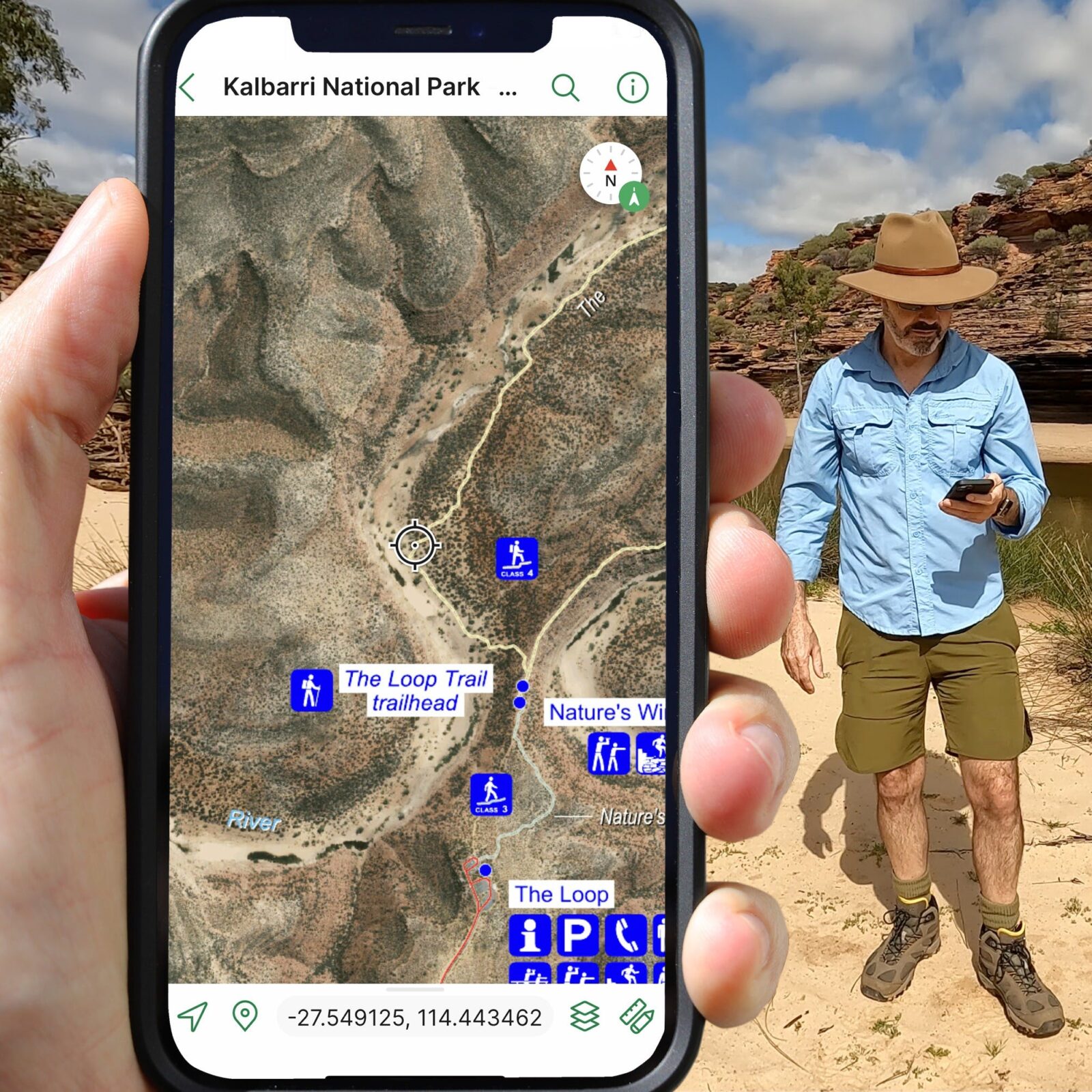
Smartreka maps are free downloadable digital maps for WA’s most popular national parks.
They make it easier to navigate and plot your real-time location without a network connection by using built-in GPS capabilities on a smartphone or tablet to plot real-time location.
If the maps are downloaded ahead of your trip while you have access to the internet, you will be able to use them to navigate in areas where there is no network connection and without roaming charges.
Currently, 15 Smartreka maps are available for the following national parks:
Cape le Grande, Cape Range, D’Entrecasteaux , Fitzgerald River, Francois Peron, Kalbarri, Karijini, Leeuwin-Naturaliste, Millstream Chichester, Mount Augustus, Purnululu, Stirling Range, Walpole-Nornalup, Walyunga, and Yanchep national park.
More maps are being developed for more national parks in Western Australia.
The maps have information on access, parking, toilets and other facilities, trails, camping and picnic areas, lookouts, swimming, roads, tracks and safety. Visitors can add place-marks and photos and measure distances. Some maps include wheelchair access and Wi-Fi information.
The free, interactive Smartreka maps can be accessed via the free Avenza Map app from either the Google Play Store or Apple iStore.
For more details, visit: https://www.ourwaparks.org.au/smartreka/