Search

Augathella Flood Markers
Things To Do Augathella, Murweh, Queensland
Historical Sites and Heritage Locations
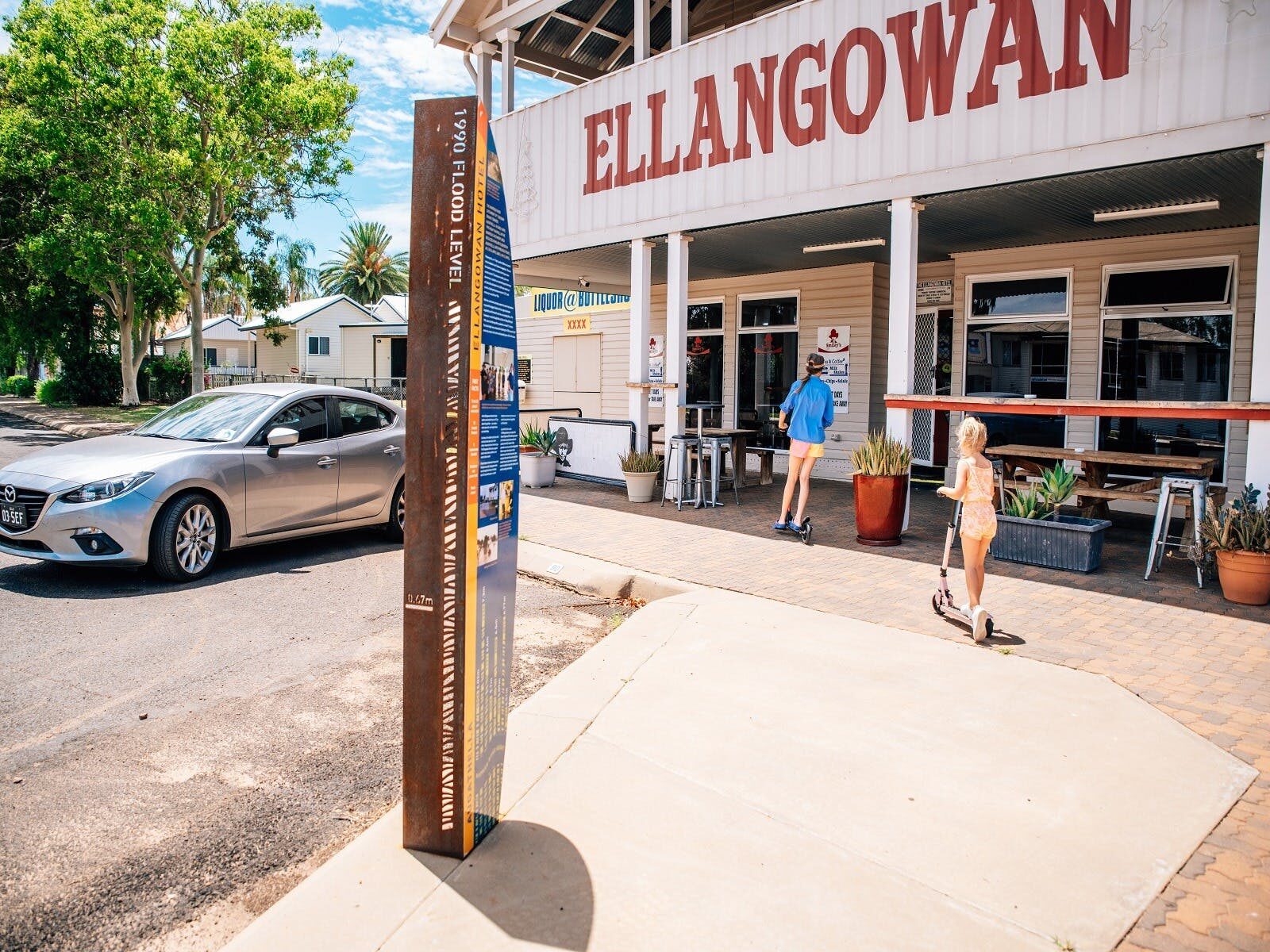
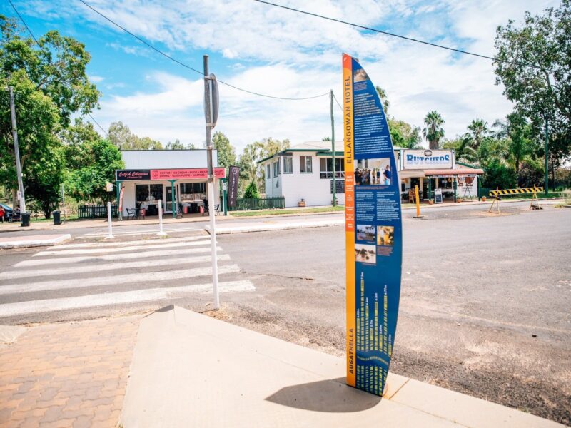
These markers tell the story of the biggest flood in the history of this region. As the water in Warrego River rose and met with Bradley’s Gully, Charleville was submerged.
Each flood marker is placed at a specific location around town to tell the story at that place.
These markers show you how high the water was at that location, and include photos from 1990.
What you can do to learn more!
The flood display, at the SES building, tells the full story of the devastation caused to Charleville.
Can you visualise what height the flood waters reached?
To see the water height and impact of the flood – Follow the flood marker trail in Charleville and in Augathella. The flood markers in Charleville form a trail of destruction around town.
If you follow the flood markers trail, then you will really understand what the people and businesses of Charleville experienced in 1990. The flood markers include the water height, photos, a short story about the location, and a couple of fast facts about the flood. At some places you can enter the business and see how high the water was inside.
Can you imagine the damage and the effort to clean up the mess?
Rates
Free Entry