Search

Exhibition and Shows
26 Apr 2024 to 31 Dec 2024 Daily Event
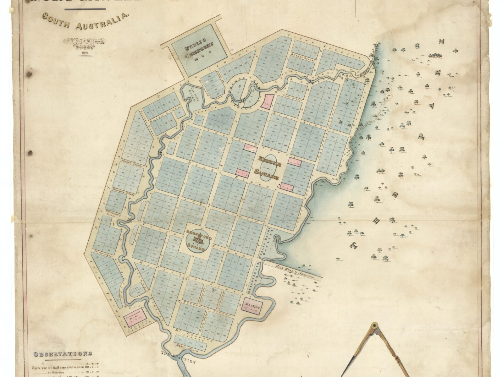
This hand-coloured, gilded map is a new addition to the State Library of South Australia’s collections, and has an extraordinary tale to tell.
Generously presented by the Friends of the State Library, The Town of Port Gawler map was created under commission by surveyor Philip L.S. Chauncy and finished in 1840. The map shows neat parcels of land, a town square, a market, and cemetery laid out between two creeks of the Port Gawler River. But the town of Port Gawler was never built.
Dig deeper into the story of this proposed town, and you will find a scandalous story of brotherly betrayal, colonial price gouging and legal intrigue which gripped the early Adelaide community, over land and waters traditionally owned by the Kaurna people of the Adelaide Plains.
The map is on display in the Mortlock Chamber of the State Library.
Facilities
Cafe
Family Friendly
Non Smoking
Public Telephone
Public Toilet
Internet Access
Free WifiRates
Free Entry
Event Dates
Daily Event
26 Apr 2024 to 31 Dec 2024